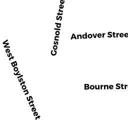
14 BOURNE ST
Owner Information
SAMBITO,THOMAS A + BARBARA J
742 MASON ROAD
JEFFERSON, MA 01522


Property Details
14 BOURNE ST is classified as a Three-Family Residential (Three family).
The primary structure on this property was built in 1915. There are 7,617ft2 of built area within this property. There is 3,882ft2 of residential/living space within this property. This property is listed as having 15 rooms.
14 BOURNE ST is valued at $404,700. The land is valued at $57,400 and the structures are valued at $346,700. There is an additional valuation of $600 on this property.
This property is in Zone RG-5. Confirm with local Zoning Board authorities to ensure there are no overlays or other easements on this property.
The most recent deed for 14 BOURNE ST is recorded at the local registrar in Book 19435, Page 0084. 14 BOURNE ST was last sold on Monday, December 15, 1997 for $90,000.
Assessment data from fiscal year 2021.
Flood Data
According to the FEMA National Flood Hazard Layer, this property does not appear to be in a flood zone. It may also be in an area not yet reviewed. Nonetheless, confirm this information prior to taking any action.
To view the flood hazards around this property, create a FEMA "Firmette" Map of the area around 14 BOURNE ST.
Broadband Internet Providers
| Provider | Type | Bandwidth (mbps) | |
|---|---|---|---|
| VSAT Systems, LLC. | Satellite | 2 | 1 |
| Crown Castle Fiber | Fiber | 0 | 0 |
| Viasat Inc | Satellite | 100 | 3 |
| Charter Communications Inc | Cable | 940 | 35 |
| T-Mobile | Fixed Wireless | 25 | 3 |
| GCI Communication Corp. | Satellite | 0 | 0 |
| Verizon New England Inc. | DSL | 15 | 1 |
| HughesNet | Satellite | 25 | 3 |
Broadband service provider data from December 2020.
Adjacent Properties
- 16 BOURNE ST
Three-Family Residential owned by KAVANAGH,CHRISTOPHER - 12 H BOURNE ST
Apartments with Four to Eight Units owned by LARSON,CLIFFORD+ WANDA - 11 WATSON AVE
Accessory Land with Improvement owned by PROIA, JAMES J TRUSTEE+ - 15 WATSON AVE
Single Family Residential owned by SWEDBERG,CURT - 13 WATSON AVE
Three-Family Residential owned by PROIA,JAMES J TRUSTEE+